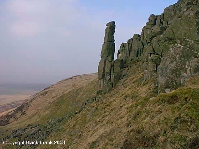
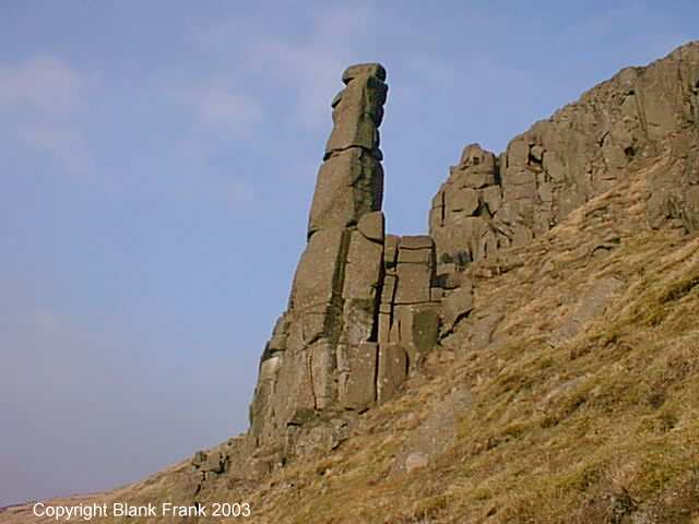
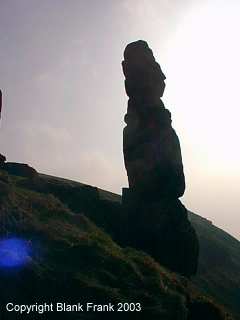
Continuing my occasional series of articles about interesting lumps of stone with names, here's a nice one I went to see called Carlin Maggie. Looking distinctly like something from Easter Island, but a lot older and natural, this is only a couple of miles SSW from the Bonnet Stane as the glider flies (as it happens, there were actually quite a few in the air around the hill on the day I went). It is said by some to be a Member of the so-called Scottish Parliament, turned to stone by the interminable wait for the completion of the new Parliament Building, and by others to be a witch turned to stone by some disgruntled devil, and by me to be an interesting-looking stone with a name. It is a rock pillar I estimate to be 30 feet high, on the Western slope of Bishop Hill, overlooking Loch Leven in Perth and Kinross, Scotland. The OS grid reference is NO 18403 04413.
Unlike the Bonnet Stane, this one is decidedly not easy to get to, and I thoroughly recommend that you DON'T GO THERE. You've got the pictures, so leave the stupidly dangerous exercise of actually visiting it to idiots who have gone there to photograph it on your behalf :-) Take it from me, you end up scrambling up and down 45-degree grassy slopes, and if you put a foot wrong you may end up rolling many hundreds of feet down to the bottom, with nothing to grab onto except deposits of sheep excrement. This is definitely not for the ill-equipped, the faint-hearted or the weak-lunged. Am I making this clear enough? It is possible to get more distant views of it from above and below with less risk by taking less direct routes than the one I used, but you still have to find the correct viewpoints and angles to see it at all. I walked up Bishop Hill from Kinnesswood, which is one of the 'official' routes (some others having been blocked by landowners) but was amazed at just how steep it was - this is the part I considered unreasonably dangerous. Finding no suitable paths as I approached the top, I just had to strike out in as straight a line as I could manage (my GPS unit was a great help to me when attempting to reverse the route on the way back down afterwards). Once I reached the top, around 1500 feet, I headed roughly North following some tracks along the Western extremity of the hill for a little under half a mile and managed to get a clear - if distant - view of the rock formation to the North, protruding from the craggy Western slope. If you must go there, I suggest you don't attempt the antics required to get within touching distance of the rock and take these photos - pay someone in the local gliding club to fly you round it. And if you do go, make sure you have suitable equipment to cope with the terrain, the weather and fluid requirements. This is no walk in the park. On the plus side, you get a great mobile signal.
By the way, the background image on this page is an accurate representation of the path I took, together with OS Grid target points. You can snag the image, tweak the colours and scale it with your picture tool of choice, and use it as an overlay on your OS map, if you really want the full multimania experience.
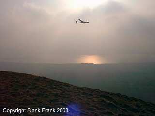
And finally, here's one of the gliders I saw from the top of the hill. The sun is reflected off the surface of Loch Leven, through the mist.